LYNN SHORE & NAHANT BEACH RESERVATION:
NAHANT HERITAGE TRAIL/NAHANT LOOP:
LYNN-NAHANT, MASSACHUSETTS
-BIKE IT OR HIKE IT-
Last Updated: August 01, 2023
Length: Lynn Shore & Nahant Beach Reservation; 2.9 miles
Nahant Heritage Trail; 1.4 miles
Nahant Loop; 6.4 mile Loop
Difficulty: Lynn Shore & Nahant Beach Reservation; Easy. Flat paved trail.
Nahant Heritage Trail; Moderate. Paved, hard packed dirt & grass trail with some small hills.
Nahant Loop; Moderate. Paved, hard packed dirt & grass trail, on-road sections and some small hills.
Directions:
To Start from Humphrey St/Lynn Shore Drive; From the junction of Routes 1A/129/129A travel southeast on Route 129 to Humphrey St. On-street parking is available along the trail which travels along the seawall and begins near the intersection with Burrill St. Heading south into Lynn the street becomes Lynn Shore Drive. Further south along Nahant Rd, parking lots are available [Parking Fee].
The Lynn Shore & Nahant Beach Reservation is a paved path that travels from Swampscott through Lynn to Nahant atop the seawall that separates the road from the beach. It is part of the DCR (Massachusetts Department of Conservation & Recreation). The Nahant Heritage Trail is a town-owned trail that links Short Beach to Bailey's Hill in Nahant. The Nahant Loop is a tour of this island I created that utilizes part of the Nahant Heritage Trail, as well as, on-road sections and other paths. This loop also connects to the Lynn Shore & Nahant Beach Reservation path. For more information visit; LYNN SHORE/NAHANT BEACH & NAHANT HERITAGE TRAIL .
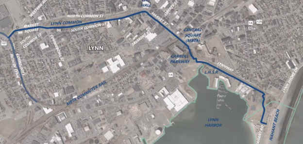
The Border to Boston Trail is an emerging 28-mile shared use trail linking eight communities from the New Hampshire border south to Boston’s North Shore. See; BORDER TO BOSTON TRAIL . The Northern Section consists of the Clipper City Rail Trail and Eastern Marsh Trail in Newburyport and Salisbury which are part of the Coastal Trails Network . A gap exists in Georgetown and Boxford where the trail is partially developed. The North Central Section travels through Topsfield, Wenham, Danvers and Peabody. The Border to Boston Trail; North Central Section; Topsfield Linear Common, Wenham Rail Trail, Danvers Rail Trail & Peabody Rail Trail follow the rail bed of the old Danvers & Georgetown RR which was chartered in 1851. In 1855 this line merged into the Newburyport RR and in 1860 it became part of the Boston & Maine RR/ Newburyport Branch. The Grand Wenham Canal may be accessed from the Topsfield Linear Common. In Peabody you connect to the Independence Greenway . Another gap exists to the Border to Boston Trail; South Central Section which consists of the Salem Bike Path, Marblehead Rail Trail, & Swampscott Rail Trail. Another gap exists to the Southern Section which consists of the Lynn Shore & Nahant Beach Reservation & Northern Strand Community Trail .
The Border to Boston Trail is part of the EAST COAST GREENWAY , a planned biking & hiking route stretching 3,000 miles from Maine to Florida. When complete it will traverse 15 states with a mostly off-road path.
Lynn Shore & Nahant Beach Reservation:
Starting from Swampscott [Northern End]; The double-wide sidewalk begins in Swampscott next to the Red Rock Bistro & Bar across from Redington St and travels southwest between the seawall and Humphrey St. You quickly cross into Lynn and travel between Lynn Shore Drive and King's Beach. There are 1/4 Mile Markers imbedded in the sidewalk and informational signs along the trail. Come to Red Rock Park after 0.7 miles and bear left following the seawall around the park and back between Lynn Shore Drive and Lynn Beach. After 1.4 miles you'll come to a rotary and cross-walk over Lynn Shore Drive.
Note; You can take a side trip from here to check out Waterfront Park and Lynn Heritage SP. Follow a series of cross-walks to a sidewalk and travel left alongside Lynnway. After 0.4 miles you'll pass by a pedestrian bridge that crosses Lynnway to Waterfront Park. Continue alongside Lynnway and follow the paved path right as it travels through North Shore Community College to Broad St. Turn right and follow the sidewalk to Washington St. Left, just up Washington St is the LYNN HERITAGE VISITOR CENTER on the right after 0.8 miles.
Continue south passing by the Ward Bath House & parking lots as the paved trail now travels alongside Nahant Beach. Watch for drifting sand on the trail! This section can be tricky with beach goers crossing the trail to the parking lots. Keep alert. Pass by the Halfway House at 2.4 miles. You come to the end of the paved trail at a parking lot after 2.9 miles next to Tides Restaurant.
You can extend your trip around Nahant Island along the Nahant Loop, which utilizes the Nahant Heritage Trail and on-road sections.
Nahant Loop:
Continuing from the Southern End of the Lynn Shore & Nahant Beach Reservation; [Continuing Mileage] Travel out past the Tides Restaurant to Nahant Rd and head left on-road. This will take you past Little Nahant Island. Just past the island you'll pick up the paved Nahant Heritage Trail on your left at 3.2 miles, which travels between Nahant Rd and Short Beach. You'll pass by the Nahant Life Saving Station and turn off for Castle Rd before coming to an intersection at 3.6 miles. Left is an access path for Short Beach. Turn right and follow the cross-walk to a sign board in the Lowlands Park parking area (parking for permit holders only). Continue straight along the Nahant Heritage Trail which now consists of a hard packed dirt and grass surface as it weaves scrub and tall grasses. Bear left at the next intersection (arrows posted along the trail, as there are many side trails). Cross a culvert and bear right. You'll emerge at Flash Rd where a green cross-walk brings you to a narrow paved path.
Note; If hiking, the Nahant Heritage Trail follows the grass through the Flash Road Playground.
If biking, your mostly done with the Nahant Heritage Trail. Travel right along this paved path or on-road along Flash Rd. Just past the Nahant Fire Dept turn left along a service road past the Public Works Dept, then right past the ball fields and left behind Johnson Elementary School. Follow this out to Castle Rd and head left on-road. Turn left on Gardner Rd, then right up and over Trimountain Rd. This will bring you down to Bass Point Rd where you'll turn left into Bailey's Hill Park at 4.6 miles.
Note; You can take a side trip up Bailey's Hill by heading right up the paved trail. This brings you to the top of the hill after 0.1 miles where the pavement ends.
Travel around the paved road where you'll pick up a dirt road. This will bring you to Willow Rd next to Kelly Greens Golf Course. Travel right on-road following Willow Rd out past Dorothy Cove. Travel past Marjoram Park and Tudor Wharf at 5.6 miles. A slight hill brings you up to Cliff St where you head left inland. Large old houses and the beautiful Nahant Village Church. Turn right along Vernon St, then left on Swallow Cave Rd. Look right to spot the steel doors for the underground battery built into the hill during the 2nd World War. After 6.5 miles you'll come to Nahant Rd and the entrance for Canoe Beach and the Northeastern University Marine Science Center. Turn right past the jagged coastline and gate for the Marine Center. Bear right past the buildings and travel straight through a narrow gap to a paved road. Turn left and head up past a sign for Lodge Park where a Loop road circles a grassy knoll with expansive views of the Mass Bay and rocky shore below. Return through the narrow gap and turn right along the road. Here you'll find a second battery "John B Murphy-1942", soon followed by a third battery. Exit the Marine Center grounds left after a 0.8 mile Loop. Turn right along Nahant Rd which affords wide open views of the Bay. Just past an observation deck (with stairs leading down to a beach) the road turns inland. Just past the stone Nahant Public Library & Town Hall you'll find a convenience store. After passing by the Nahant PD & Greenlawn Cemetery you'll pick up a paved trail on your right along Short Beach. This brings you back to the Nahant Heritage Trail after 8.8 miles. Continue straight back along the trail, then on-road back to the Southern End of the Lynn Shore & Nahant Beach Reservation for a 6.4 mile Loop.
Northern Strand Community Trail Connection:
Note; Future construction (2023) will extend the Northern Strand Community Trail from Western Ave in Lynn east 2 miles to Nahant Beach. See Below.

HH
CLICK HERE FOR LYNN SHORE & NAHANT BEACH RESERVATION MAP
CLICK HERE FOR NAHANT HERITAGE TRAIL MAP
CLICK HERE FOR NAHANT LOOP MAP
BEFORE YOU SET OUT BE SURE TO READ THE
WAIVER OF RESPONSIBILITY AND DISCLAIMER
BIKE IT OR HIKE IT