MILL CREEK RIVERWALK:
CHELSEA, MASSACHUSETTS
-BIKE IT OR HIKE IT-
Last Updated: July 08, 2025
Length: Mill Creek Riverwalk; 0.8 miles
Difficulty: Easy. Flat paved trail.
Directions:
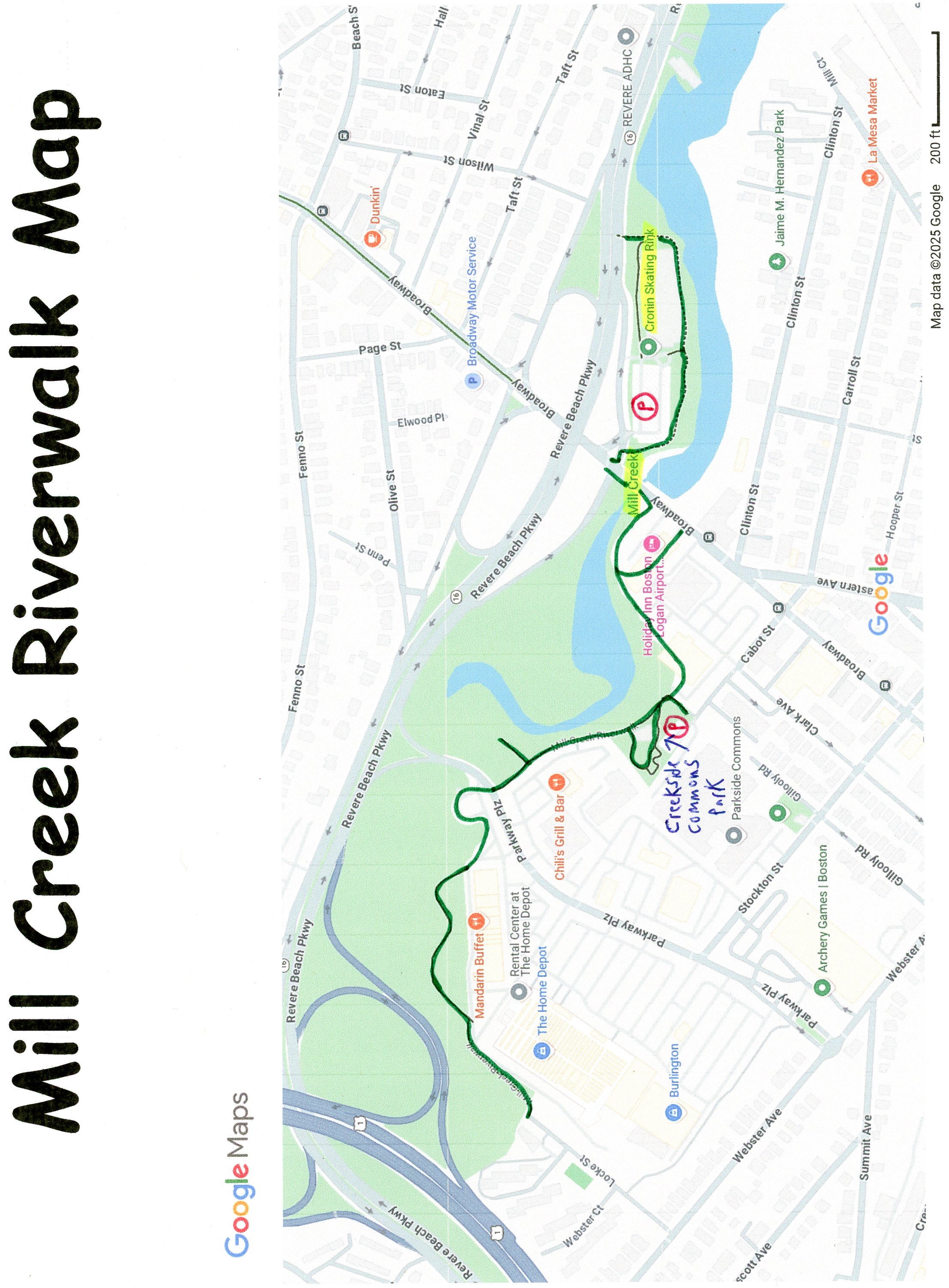
To Start from Cronin Skating Rink parking lot [Eastern End]; From the traffic circle at Routes 1A, 16 & 60 in Revere travel south on Route 16 (Revere Beach Pkwy) for 1 mile Take the Broadway exit and travel left underneath the Pkwy. Take your first left, then quick right into the Cronin Skating Rink parking lot. Spot the Bike parking spots on your right.
The Mill Creek Greenway travels East-West, alongside Mill Creek. Mill Creek and connecting Chelsea Creek are important estuaries for both marine life and shorebirds. Visit; MILL CREEK RIVERWALK .
Starting from Cronin Skating Rink parking lot [Eastern End]; The trail starts from the entrance to the parking lot.
Note; A stone-dust trail travels East, around the Skating Rink along the Northern Side of Mill Creek out to Revere Beach Pkwy after 0.2 miles.
A cross-light takes you over Broadway. Head left, over the creek, where the wide, paved Mill Creek Greenway begins on your right. Map Board and informational signs.
Note; Funds were approved to design a boardwalk section from Broadway, East, along the river.
The trail travels West, along the Southern Side of the Mill Creek Estuary on your right and commercial buildings on your left. The trail narrows briefly. Travel past a playground at 0.2 miles. Pass by a spur on your right to an overlook of the creek before crossing Parkway Plaza. Trail continues between the creek and commercial buildings ending after 0.6 miles on Locke St. Map Board.
HH
BEFORE YOU SET OUT BE SURE TO READ THE
WAIVER OF RESPONSIBILITY AND DISCLAIMER
BIKE IT OR HIKE IT