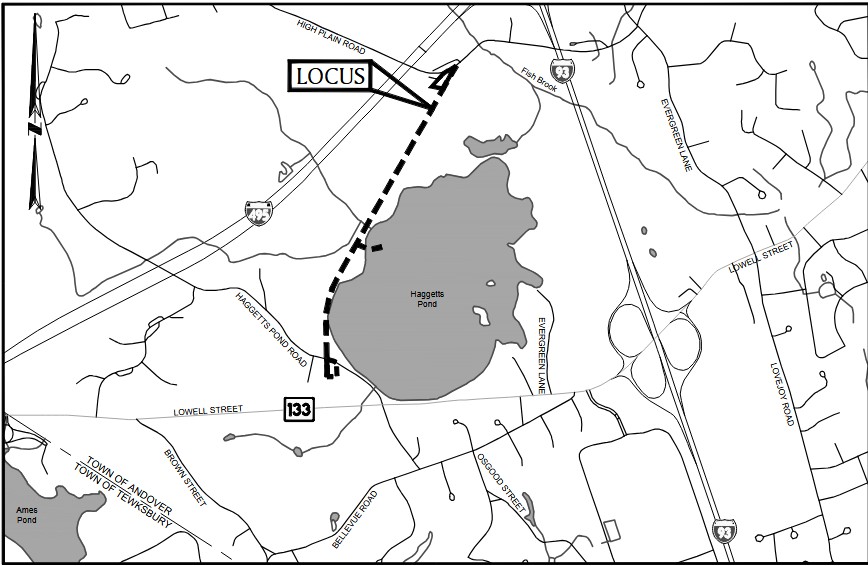
HAGGETTS RAIL TRAIL:
ANDOVER, MASSACHUSETTS
-BIKE IT OR HIKE IT-
Last Updated: May 02, 2026
Length: Haggetts Rail Trail; 1 mile
Difficulty: Easy. Paved & hard packed dirt & gravel rail trail.
Directions:
Starting from High Plain Road parking area [Northern End]; From I-93 take exit 39 to Route 133 and head east to Greenwood Rd. Head left and travel 0.8 miles to High Plain Rd. Head left, traveling underneath the highway and come to the parking lot on your left after 0.6 miles.
Starting from Haggetts Pond Road parking area [Southern End]; From I-495 take exit 94 to Route 133 and head east for 1.3 miles. Turn left onto Haggett's Pond Rd and you'll quickly come to a small parking area on your right.
Haggett's Rail Trail follows the former rail bed of the Lowell & Lawrence RR North-South and passing by Haggett's Pond. For more information visit; HAGGETTS RAIL TRAIL .
Starting from High Plain Road parking area [Northern End]; Travel past the gate and you'll come to a Map Board. The hard packed dirt & gravel Haggett's Rail Trail travels South, through the woods. The trail becomes paved after 0.4 miles. Exit the woods and cross a causeway between Haggetts Pond and a marsh. Trail continues through the woods and alongside Haggetts Pond, bringing you to the Haggetts Pond Road parking area after 1 mile.
Note; South, the old rail bed is not accessible at this time, however, Phase 2 construction will extend the trail another 0.6 miles to Bellevue Rd, where another parking lot will be built.
HH
BEFORE YOU SET OUT BE SURE TO READ THE
WAIVER OF RESPONSIBILITY AND DISCLAIMER
BIKE IT OR HIKE IT